Evidence of meeting #58 for Procedure and House Affairs in the 44th Parliament, 1st Session. (The original version is on Parliament’s site, as are the minutes.) The winning word was riding.

A video is available from Parliament.

On the agenda

MPs speaking

Also speaking

11:05 a.m.

Liberal

The Chair Liberal Bardish Chagger

Good morning, everyone.

I call the meeting to order.

Welcome to the long-awaited meeting number 58 of the Standing Committee on Procedure and House Affairs. The committee is meeting today to begin its study of the Alberta electoral boundaries commissions report for the first hour and the Quebec electoral boundaries commission report in the second hour.

I want to thank you, colleagues, for coming back. I know we invited you in the past and that changed. Then we asked you to turn around really quickly, and you all have. That means a lot to us here at PROC. We acknowledge it and appreciate it.

The clerk and I will maintain a consolidated speaking list of members wishing to speak. I am sure it's going to be a very pleasant meeting. If it cannot be, I need all comments to go through the chair. Otherwise, among colleagues, I think we are good to go.

For colleagues on PROC, I would like to share that there are two budgets we will need to approve. There was also a letter sent around from the Joint Interparliamentary Council, which I think we can find a way forward on. I would encourage some side conversations so we can maintain the business of committee to stay focused on where we need more time. I'll leave that with you, as you are masters of this domain.

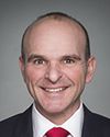
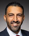
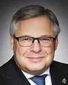
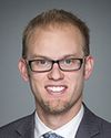
For our first panel, we have with us the Honourable Randy Boissonnault, George Chahal, Gerald Soroka, Arnold Viersen and Chris Warkentin.

With that, you will have up to four minutes for opening statements. I would appreciate any extra time back, rather than asking you to conclude your comments.

Minister Boissonnault, the floor is yours. Welcome to PROC.

11:05 a.m.

Liberal

Randy Boissonnault Liberal Edmonton Centre, AB

Thanks, Madam Chair, and good morning, colleagues.

I truly appreciate this opportunity to come to PROC. I want to thank the committee members for their hard work on reviewing boundary readjustment reports. Meeting 58 tells me all I need to know.

It is a testament to the strength of our democracy that we have these open processes to create electoral district boundaries that, as best as possible, maintain population equality while taking into account important social and geographic factors. The process to date has been orderly—

11:05 a.m.

Liberal

The Chair Liberal Bardish Chagger

I am just going to pause the time to say that, as Canada has two official languages, we just need to maintain a bit—

11:05 a.m.

Liberal

Randy Boissonnault Liberal Edmonton Centre, AB

I'm going too fast. I told the translators I would be slower.

11:05 a.m.

Liberal

The Chair Liberal Bardish Chagger

I'm sure you've never heard that before.

11:05 a.m.

Liberal

Randy Boissonnault Liberal Edmonton Centre, AB

I will speak more slowly, Madam Chair.

11:05 a.m.

Liberal

The Chair Liberal Bardish Chagger

We would be very grateful.

11:05 a.m.

Liberal

Randy Boissonnault Liberal Edmonton Centre, AB

Friends, I want to thank the non-partisan Alberta commission for its work and for efforts made following the public hearing process to respect some of the traditional geographic boundaries in Edmonton. One of those is 97 Street. We worked hard with colleagues to make sure 97 Street would be the boundary for the riding of Edmonton Centre, reflecting years of history.

With the utmost respect to the commission, I would like to share my concern that the proposed northern boundary of the redrawn constituency fails to account for the historical pattern for boundaries of ridings in the city of Edmonton, and the particular community of identity contained in north Edmonton in particular.

Yellowhead Highway 16 and the rail yards that run alongside it represent one of the most definitive geographic boundaries within the city. Through it, residents and products flow across, into and out of our city. Indeed, I'm proud to say that our government is currently partnering with the provincial and city governments to turn Yellowhead into a full freeway. It's a massive and long-awaited project that is going to benefit residents and bring more Canadians and visitors to our city.

While freeways like the Yellowhead are really important to connect people, they have the understandable effect of geographically separating neighbourhoods physically and psychologically, so it is little surprise that this boundary has been the northern boundary for almost 40 years, for everything from municipal to provincial ridings and boundaries. It is a clear boundary distinction between north and central communities.

Significantly, it is the border of 18 neighbourhood community leagues that run along the freeway. I believe this most strongly represents institutional recognition of this as an appropriate boundary.

Despite this, under the proposal there are three distinct communities north of the highway that have been separated from other north Edmonton communities and put into Edmonton Centre. This would put these neighbourhoods in a federal riding that is separate from their public school division and their provincial and municipal representation, and separate from the unique character that makes up north Edmonton. Respecting the community of identity contained in an electoral district cannot permit separating these communities from similar north Edmonton communities in this way.

Furthermore, this proposal fails to take into account the nature of this freeway as a major geographic feature of Edmonton. Therefore, I would propose that the northern border of Edmonton Centre remain the Yellowhead Highway.

I recognize that this correction may impact the population of the proposed Edmonton Centre electoral district. To respect the commission's median population quota, I would propose that the communities of Parkview and Laurier Heights be returned to Edmonton Centre. These neighbourhoods are well connected with the communities on the southwest border of the new riding. They share community leagues, schools and hockey rinks, and they would be well served by remaining in the riding they have been in since 2004.

So, dear colleagues, I am proposing that the Yellowhead Highway remain the northern border of Edmonton Centre and that, on the population issue, the communities of Parkview and Laurier Heights be returned to Edmonton Centre.

11:10 a.m.

Liberal

The Chair Liberal Bardish Chagger

Thank you, Mr. Boissonault.

Mr. Chahal, the floor is yours.

11:10 a.m.

Liberal

George Chahal Liberal Calgary Skyview, AB

Thank you, Madam Chair and colleagues at PROC.

I've provided an objection to the Alberta commission electoral boundaries proposal as well. I have two concerns with the proposed riding.

The first concern is around the northern boundary of Calgary McKnight, and the other concern is about the proposed names of the two northeast Calgary ridings.

Starting off with the northern boundary of Calgary McKnight, there are two maps here for your reference. One is of the whole city, and the other is an image that provides some clarity on the areas I will be discussing.

The proposed northern boundary of Calgary McKnight should include all homes south of 96 Avenue, which is Airport Trail. That's a highway that divides both of these constituencies. The most northeastern corner of the Saddle Ridge neighbourhood is currently included in the new riding of Calgary Skyview, as highlighted in yellow on the map. You'll notice that highlighted in blue is the highway that divides both communities.

You will also notice that north of the blue Airport Trail there are a number of lands that are undeveloped. Those are future undeveloped lands. This part of the city has some of the highest growth that we've seen as a city. From the 2021 census, I would argue that we may have already potentially increased population in the new north riding by 25,000 to 30,000 individuals. The other important item to note is that the yellow-shaded area cannot be accessed by the constituency to the north. All entry points into that area of Saddle Ridge must be through Calgary McKnight. This area of Saddle Ridge also shares a community association or, as it's referred to in other cities as well, a “community league”.

The submission originally provided by many local leaders, elected officials and community organizations requested that a proposed riding use Deerfoot Trail, and northeast Calgary is very unique along boundaries such as major highways.

The commission also acknowledged that paragraph 15(1)(b) of the act goes on to provide that the commission shall also consider the following criteria:

the community of interest or community of identity in or the historical pattern of an electoral district in the province

I'd like to note for committee members that there is no impact on any ridings other than Calgary McKnight and Calgary Skyview, which is the new riding defined by the electoral commission. As mentioned, Calgary Skyview is the fastest-growing riding in the city of Calgary and the Calgary region. There's a lot of land that is currently planned and ready for development.

In terms of the impact on the two ridings, for the total population of Calgary McKnight, with the yellow area included in Calgary McKnight, it would bump up the numbers to about 131,000. The total population of Calgary Skyview would be reduced to about 107,000. This is not including any growth that has occurred over the last three years and, as mentioned, I believe we've seen about 25,000 to 30,000 new residents already in this area of Calgary Skyview.

There is a population variance. There is a precedent for this variance across the country. We've seen Dartmouth—Cole Harbour, with a variance of close to 19%. We've seen Moncton, with a variance of about 18.5%, and Kingston and the Islands, with a variance of about 15.3%. There is a precedent nationally.

The most important thing is that community members living in these communities be kept together and not separated from their places of worship—

11:15 a.m.

Liberal

The Chair Liberal Bardish Chagger

Mr. Chahal, we haven't had a meeting like this for a little while, so our technical skills are being improved, and your time is up.

Thank you.

11:15 a.m.

Liberal

George Chahal Liberal Calgary Skyview, AB

Oh, okay.

11:15 a.m.

Liberal

The Chair Liberal Bardish Chagger

Just so you know, it's four minutes and seven seconds, so you went up by seven. The “beep, beep, beep” did not happen. In future you will hear a “beep, beep, beep”, and that will mean your time is up.

Mr. Soroka, the floor is yours.

11:15 a.m.

Conservative

Gerald Soroka Conservative Yellowhead, AB

Thank you, Madam Chair and committee.

I guess I would not be here today if I felt the commission had done properly everything it should have. When it first proposed this to the riding of Yellowhead, it was to increase it by about 12%, and I'm talking population, not area. That's about the only significant change.

What it has done, though, is to completely rearrange the entire riding, so that now I have 45% of the original riding and about 55% that's brand new. That, to me, is a substantial change. That is why I am here today to argue these points: There's no more continuity in any shape or form from north to south. I have essentially Calgary residents and, seven hours away, Grand Cache, a small coal-mining town, but also forestry, oil and gas, so quite a differentiation between them and the tourist areas on the west side, with Jasper and Banff national parks, and then Kananaskis Country.

When I start looking at the rationale, the commission itself didn't seem to make sense when it made the changes. When it first talked about continuity, that made sense. What it did was to combine certain ridings or make a new riding in an area that didn't exist before in the proposal. Doing that really reconfigured all of Alberta. When I say it didn't make it consistent, I mean it tried to make sure certain counties were together, so then it chopped Yellowhead in half.

On one hand they say, “We want to keep counties together,” and on the other hand they say, “No, we'll divide them.” Rocky View County now has four MPs representing it, so that doesn't make sense. When they start looking at populations, everyone is trying to get around 116,000. Now they have variances from 121,500 all the way down to 110,000, so again they didn't follow their own mandate. Doing a lot of these things means there isn't the continuity that I thought there would be.

They want to change the name from Yellowhead to Jasper—Banff—Canmore. I want to maintain the name Yellowhead for the historical value as well as the significance of David Thompson, the explorer. His name was “Yellow Head” or “Tête Jaune” in French. Apparently, they spoke a lot more French back then than they do now in my riding. That's the historical significance behind it. This is the reason I want to put Yellowhead back together. It's hard to maintain the name of Yellowhead when you have Yellowhead County split in half.

That is my main proposal. I know for a fact that it still doesn't address what I'd like it to do. I'd prefer to go back to the original proposal. That made a lot more sense to me. By making these changes, yes, I'm affecting essentially five different ridings, but I have the full support of my fellow MPs. I'm not trying to make a change that will benefit one voter or one riding over another. Alberta, as you're well aware, is very strongly Conservative, so there isn't this, “Oh, my goodness, now we're trying to balance this out a little differently.” That's not going to be a factor.

Those are really my whole premises behind everything. I think I'll leave it there.

Oh, yes. Some mayors have also written letters giving their support as well.

Other than that, because I have full support and everything going through, I also feel that the boundary changes that I proposed will bring us to within 1,000 of that 116,000, so my recommendation comes a lot closer to what was desired as opposed to their proposal, which would be 5,000 to 6,000 over or under. As well, the boundary lines I've drawn make a lot more sense, with straight lines as opposed to all the curves and changes that way.

Thank you, Madam Chair.

11:20 a.m.

Liberal

The Chair Liberal Bardish Chagger

Thank you, Mr. Soroka.

I really appreciate your going through our questions. That was noticed, and I want you to know that I appreciated that.

Mr. Viersen, you have up to four minutes.

11:20 a.m.

Conservative

Arnold Viersen Conservative Peace River—Westlock, AB

Thank you, Madam Chair.

The rationale for the proposal I'm making—I think Mr. Warkentin and I are making the same recommendation—is that there was not a lot of objection to the original proposal. It seemed to make sense.

The ridings are called “Peace River” and “Grande Prairie” and, typically, folks who live in the particular ridings would like to be associated with the respective name. Grande Prairie is a distinct community, and Peace River is more of a geographical area in the Peace River basin. We call it “the Peace country”. It would be nice to keep folks who are associated with Grande Prairie in the Grande Prairie riding.

For example, I live about a four-hour drive from Grande Prairie. If I were going to Bezanson, DeBolt, Crooked Creek, Sexsmith, Beaverlodge, Wembley or La Glace—all or any of those communities—I would just say, “I'm going to Grande Prairie on the weekend,” even if I were not going to the actual city of Grande Prairie but to that general region.

Now, if you were going to High Level, for example, you'd say, “I'm going to High Level.” Folks from High Level have to pass through the town of Peace River. They live on the banks of the Peace River. They have an association with the Peace River that would keep it respective; it is about the name in that respect.

The other thing is just around the folks who are still struggling to adjust. People vote in the same place for a long time. I get a lot of complaints like, “Hey, I've always voted here, so why do I have to vote there now?” That continues to be a challenge. When we mess around with the boundaries, people end up having to vote in new places, and that causes confusion.

I would suggest that we keep the boundaries the same, as much as possible. The first proposal did that fairly well. It's a logical thing to just say that the rest of Mackenzie County goes in. The logic of it is very good, and keeping folks who live near the city of Grande Prairie in the Grande Prairie riding makes a lot of sense.

There was not a lot of opposition to the first proposal. The challenge is that there isn't an ability for our communities to voice their opinion except through this forum, and they're not as engaged on it now. When I've been going through the communities and saying, hey, this is the new proposal, folks are like, “No, that's a little bit odd.” The mayor of Mackenzie County has said that the first proposal makes more sense than the second proposal. I don't believe that he spoke at all, one way or the other, on the first proposal, but I showed him the maps. I'm in the process of getting documentation to support that, but that can be provided for sure.

On the demographic consequences, given that it's the first proposal, I think the demographic consequences are fine. There's no domino effect. It's just the two big ridings in northern Alberta that are changing. I have talked to colleagues in the area, and that seems to be fine.

11:20 a.m.

Liberal

The Chair Liberal Bardish Chagger

Thank you so much. I appreciate that.

I am going to pass it to Mr. Warkentin now.

March 23rd, 2023 / 11:20 a.m.

Conservative

Chris Warkentin Conservative Grande Prairie—Mackenzie, AB

Thanks so much, Madam Chair.

Madam Chair, I've supplied committee members with a number of papers, including the current population statistics, those for the first redistribution proposal and those for the second redistribution proposal. I'll leave it up to committee members to review what we are proposing. We could talk about that in the questions and answers.

I've also identified three specific maps: the current reality, the first proposal by the commission and the second proposal. As you can see, the highlighted area is actually Mackenzie County. That is a municipality of the northern region. I believe, as does Mr. Viersen, that municipality should remain intact. I have had the privilege of serving for a number of years. I lived through the last redistribution. Prior to the previous redistribution, that municipality was in fact intact.

What's also important for committee members to understand is that not only does that municipality need to be intact, but also there are many first nations communities that live along Highway 58. If committee members look at High Level on the first map, they can identify that there's a highway that leads across that portion of the province. Highway 58 really is a connector for first nations communities in that region. There are dozens of smaller first nations communities along that highway, and when I had the opportunity to represent the entirety of that area, previous to the past redistribution, the benefit was that I would be able to have regional meetings in that area and bring everybody together. We also have a single MLA who represents that region, as well as the local municipal government, so when I would attend meetings, I was able to do that.

Currently, both members of Parliament have to drive for five hours for a single meeting when those large meetings happen. I'm certain that the commission wants to divide the land mass, so it's important, I believe, for Highway 58 to be reunited in a single riding and for the municipal district of Mackenzie to be maintained in its entirety.

Going further south, the first proposal was to bring Mackenzie County back together in its entirety. Mackenzie County and the regional folks all supported that idea. They didn't indicate that to the commission. They weren't opposed to that; they were thankful that they were finally back in the same constituency, so they didn't object.

Once the second proposal came back, which was to separate it, I heard large numbers of folks talk about their frustration with being divided again, so I think it's important to bring the municipality, the school districts and the regional hospital in High Level—so people along Highway 58 and going in that municipality—to High Level.

Moving to the southern part of the riding and the swap that happened during the first versus during the second, the commission alternatively proposed an idea that both Sturgeon Lake and the communities of Crooked Creek and Goodwin would all be separated, cut out of the Grande Prairie riding and moved into the Peace River riding. The challenge is that they really would be geographically separated from folks they actually conduct business with. They really need to be tied back to Grande Prairie. That's where all of the work is that these folks do. This is where they work. This is where they go to school. The school district stands over there.

I can answer additional questions, but hopefully that provides some clarity.

11:25 a.m.

Liberal

The Chair Liberal Bardish Chagger

That's excellent. Thank you so much.

We're going to enter into six-minute rounds. I know there is a desire to see more than one round. You can see the clock, and you know when the panel ends, so if you have any extra time, you're welcome to pass it back to me and I'll keep the meeting moving.

Otherwise, we'll have six-minute rounds, starting with Mr. Cooper.

11:25 a.m.

Conservative

Michael Cooper Conservative St. Albert—Edmonton, AB

Thank you very much, Madam Chair.

It's great to see my Alberta colleagues here. I'm going to ask my first question to Mr. Boissonnault.

I take your point with respect to Yellowhead Highway, but in terms of the historical pattern of ridings, you submitted that this had been the boundary line for Edmonton Centre for the better part of 40 years. However, I would respectfully note that this isn't so. Prior to 2004, the former Edmonton West riding, and the former Edmonton—Northwest riding before Edmonton West, which encompassed much of the downtown core, extended north of the Yellowhead Highway.

I would further note that the communities that will now be placed in Edmonton Centre, north of the Yellowhead Highway, including Kensington and Athlone at the provincial level, had been in the former Edmonton—Calder riding for many years, a constituency that extended on both the north and south sides of the Yellowhead Highway, represented by MLAs David Eggen, Doug Elniski, Brent Rathgeber and Lance White. The current municipal ward of Anirniq, represented by Councillor Rutherford, extends south of the Yellowhead—or north of the Yellowhead, depending on how you look at it.

I'd be interested on your comments on that.

11:30 a.m.

Liberal

Randy Boissonnault Liberal Edmonton Centre, AB

Thanks, Madam Chair. I appreciate Mr. Cooper's questions. I'll take them in reverse order.

Anirniq is a great example. Councillor Rutherford is my councillor. If you take a look at Anirniq, the piece of that riding that actually straddles Yellowhead is an industrial area with very few residents living in it. It's an industrial area that actually preceded the Yellowhead coming through the city.

I think what we're working on, Mr. Cooper, is the fundamental principle of communities of identity. I'll check the record, but if I misspoke, it wasn't that Edmonton Centre has been the way it's been for 40 years; it's that many political boundaries have respected Yellowhead as a northern or southern boundary for 40 years, including a number of the provincial MLA boundaries and a number of the city wards.

Mr. Cooper knows the riding well, Madam Chair, because his riding is just north of it.

You can even look at school boards. We are contending that if we want to keep communities of interest together, we respect that northern border of Edmonton Centre. If there is any issue with population, because we understand that the commission has to be within 5% either way of 115,000—

11:30 a.m.

Conservative

Michael Cooper Conservative St. Albert—Edmonton, AB

I don't want to interrupt you, Mr. Boissonnault—

11:30 a.m.

Liberal

Randy Boissonnault Liberal Edmonton Centre, AB

Go ahead.

11:30 a.m.

Conservative

Michael Cooper Conservative St. Albert—Edmonton, AB

—but you did make the point about the population adjustment in your submission, and given the shortness of time, I have questions for other members.

I would note that with regard to other federal ridings, Edmonton North used to extend north of the Yellowhead as recently as prior to the last redistribution, and the riding of Edmonton East extended north of the Yellowhead. There's plenty of precedent for federal ridings, provincial ridings and municipal council wards extending north or south of the Yellowhead. I'll leave it at that.

Mr. Chahal, what you are proposing would result in a significant deviation with regard to Edmonton and Calgary federal ridings. I would also note that it appears that the commission made some adjustments with respect to Saddle Ridge based upon some of the input they had received. It's noted in the report that they configured McKnight having regard to it being a densely populated part of northeast Calgary. The commission further explained that they had taken the more densely populated parts of Saddle Ridge and put them in McKnight, consistent with creating a more densely populated northeast Calgary riding and the less densely populated neighbourhoods of Saddle Ridge and Skyview.

I'd be interested in your comments on both those points.

11:30 a.m.

Liberal

George Chahal Liberal Calgary Skyview, AB

First of all, a community of interest or a community identity is identified in the act as a priority. This would go against that. Airport Trail is a major boundary. It's a highway. Saddle Ridge is one large community. Adding one part in and taking another part of Saddle Ridge out goes against paragraph 15(1)(b).

I would also like to note that for the provincial boundaries, as you addressed in your previous question, the Calgary—North East boundary is Airport Trail. The two provincial boundaries are divided by Airport Trail. There is no access into that yellow-hatched area that I've shown from Calgary Skyview. It all comes through Calgary McKnight through the community of Saddle Ridge.

The right thing to do, and what is in the best interests of community members and the community association, is to have a clear line, which is Airport Trail, to the city limits and all the way down to Métis Trail.